
What Is the Most Common Street Name in the US? An Analysis of OpenStreetMap Data.
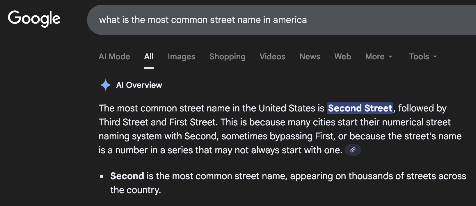
By David Gros. . Version 0.1.0 Street names are a key part of how we discuss places in the world. They can reflect what is important to a certain region (eg, key figures of a region's history) or can reflect practicalities of navigation (eg, streets named after numbers or letters). I have previously heard the counterintuitive factoid that the most common street in the US was "2nd Street". It was explained that "1st Street" and "Main Street" compete with each other, thus "2nd Street" wins out. The Google AI overview repeats this view when searched on my browser at time of writing. We analyze data from OpenStreetMaps (OSM), which is like Wikipedia but for maps. OSM is a core part of powering digital maps, and is widely supported by major companies such as Facebook, Microsoft, and Tomtom These are among the list of the largest sponsors for OSM. We find the "2nd Street Is Most Common" assessment does not replicate. Instead we find "Main St" is most common. Counting Every Street In Figure 1 we plot the 10 most common street names. However, there are decisions on how to count these. For example, whether "2nd Street" and "Second Street" should be merged. Some prior work appears to combine these. However, in a brief analysis it appears that "Second Street" only appears about 650 times; not enough to bring it into the lead. However, a future version of this article could explore other variations of normalization. Data is downloaded from state level dumps provided by Geofabrik in November 2025. This total map data is approximately 11GB. The OSM data comes in Protocol Buffer format (PBF), a compressed binary format containing nodes (points), ways (connected sequences of nodes), and their associated metadata tags. We process this data in multiple passes. First, we identify all nodes that are part of named highways. Second, we extract the coordinates for these nodes and build street segments from ways tagged with both a "name" and "highway" attribute. The challenge is that a single logical street (like "Main Street") can consist of many disconnected segments in the OSM data such as at intersections or when attributes such as speed changes. To identify unique streets, we group segments with the same name that share nodes (indicating physical connection), and then further merge nearby disconnected components if they're within 200 meters of each other. This spatial merging helps account for mapping artifacts while avoiding incorrectly merging genuinely distinct streets that happen to share a name. Segment merging process noisy. Even though we merge streets with the same name within 200 meters, there can be larger gaps (for example, when a park or highway bifurcates a street). It is unclear what is the right limit here. If the streets are not connected and are fairly far apart they seem reasonably thought of as separate streets. Future work could explore how this decision impacts the result. DC Data Missing. We currently do not include data from Washington DC. Mapping may not be fully complete It is unclear how comprehensive OSM is. While the general consensus is it is reliable in the US, some prior work has found some evidence of misalignment with government data, particularly in rural areas. Cross State Duplication We process each state independently. Streets that cross state lines could be counted twice. Broad Definition of Street. We include all kinds of streets in the data. However, this also includes "streets" like pedestrian paths or trails. However, for this question of the most common street name this is unlikely to change conclusions as the most common streets are primarily vehicular roads. Here we present what is the most common street name data from OpenStreetMaps. We believe this is the most comprehensive picture of this question. Our results differ from the common adage that 2nd Street is most common. This is part of a broader analysis of street names. Tomorrow I hope to share some of this analysis and visualization.
Introduction
Results
Overall Street Names

Methodology
Processing Data
Limitations
Conclusions